Hey everyone!
I wanted to share with you a project I’ve been working on called GeoCapture. It’s a handy tool for anyone who needs to collect geographic data without access to professional GPS equipment.
As developers in the GIS department, we often need to collect the GIS coordinates of certain locations in the field. While we usually rely on professional GPS devices for such projects, sometimes we don’t have access to them. In such situations, we have to resort to alternative methods, such as using mobile apps. However, I wanted to create my own tool that would be even simpler and more accessible. So, I came up with the idea of GeoCapture.
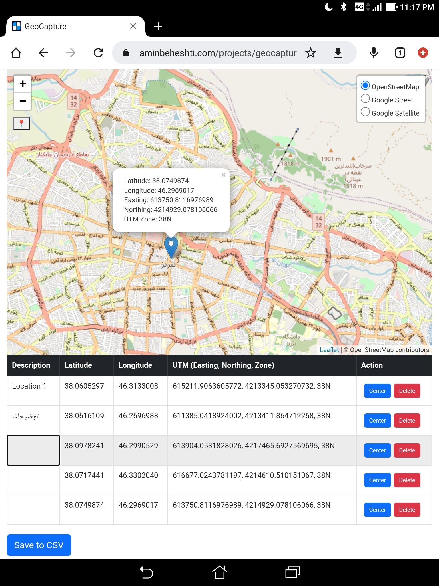
GeoCapture is an interactive map that provides a range of base maps to choose from, and enables you to easily capture the coordinates of locations of interest. With just a few clicks, you can set markers, add descriptions, and save your data in a convenient CSV file.
Using GeoCapture is super easy:
- Clone or download the repository to your local machine.
- Open the
index.htmlfile in your web browser. - Allow the application to access your location if prompted.
- Click on the map to set a marker at the desired location.
- Enter a description of the location in the table.
- Edit or delete the location information as required.
- Click the
Save to CSVbutton to download the location information in a CSV file.
GeoCapture is built using HTML, CSS, and JavaScript, and it leverages the powerful Leaflet library to create and display the map. It also uses the Proj4js library to convert latitude and longitude to Universal Transverse Mercator (UTM) coordinates.
I made GeoCapture with the goal of providing an easy-to-use tool for anyone who needs to collect geographic data without access to professional GPS equipment. Whether you’re out in the field without your GPS, or simply prefer to use your phone or computer to capture location data, this tool provides a simple and effective solution.
If you’re interested in checking it out, you can find the live preview here: https://aminbeheshti.com/projects/geocapture/.
And you can check the code out in my GitHub here : https://github.com/abport/GeoCapture .
So if you find any issues with the code or have ideas on how to improve it, please feel free to submit a pull request or open an issue.
Thanks for reading, and happy capturing!